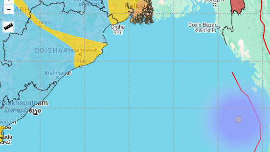

Bhubaneswar: The Bay of Bengal has recorded another mild tremor Sunday morning, 96 hours after an earth quake of magnitude 4.1 quake recorded on October 29 – exactly three days after Cyclone Dana landfall.
As per tyhe National Seismic Centre, today at the morning hours of 10:28:06, at 197 km west northwest of Pathein in Myanmar, an earthquake of 3.9 magnitude recorded in Bay of Bengal. The exact location is mentioned at as 17.3 deg N and 92.97 E. The National Seismological Centre (NSC) has estimated the origin of the tremor at 79km.
However, as per a release by United States Geologocal Survey (USGS), the magnitude of the quake has been estimated at 4.2, and the origin depth is mentioned at 10km. The place has been mentioned as the same identified by India's NSC. In October, the Bay of Bengal area around Andaman and Nicobar Islands have recorded as many as six earthquakes with magnitude varying from 4.3 to 5.5 in the ritcher scale.
Here is a list of quakes in Bay of Bengal during the last two months.
WHY QUAKES HAPPEN IN BAY OF BENGAL?
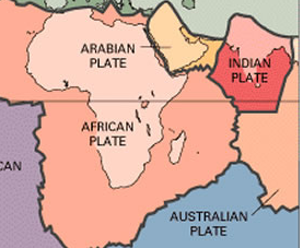
As per a research study by Abhisekh Pal, IIT Kharagpur, “It is generally agreed that seismicity in the Bay of Bengal is attributed to compressional forces at the Himalayan Front.” He added that studies done by Mallick and Rajendran and Rai in 2015 based on waveform analyses on the 2014 earthquake in Bay of Bengal, concluded that the earthquake occurred along a NW-SE oriented fault with a near vertical motion.
The study of 2014 Bay of Bengal earthquake has following pointers.
* A widely dispersed diffuse seismicity provides evidence that the intraplate region of the entire Bay of Bengal and peninsular India of the Indian plate are seismically active of which the Gangetic delta and the eastern flank of the Ninety East Ridge show somewhat higher seismicity in comparison to the thickly populated epicenters at the eastern plate boundary. (see the image below and compare with main image)


* The study found that tremor activities is due to predominance of thrust faulting earthquake mechanisms with consistent north-dipping fault planes and more or less N/S pressure axes that imply that N-S compression is more prevalent in the intraplate region of the Bay of Bengal which is analogous to the Himalayan arc. (see the image above)
The earthquakes in Bay of Bengal, thus, had no link with cyclonic activities. Because, the quake is all about the movements in the earth's crust, whereas cyclones happen due to churning in the atmosphere (above the earth crust).