

By Sanjeev Kumar Patro
Bhubaneswar: The Indian National Centre for Ocean Information services, country’s premier ocean state observation centre, has issued warning for sea swell and tidal surge along the Odisha and West Bengal coasts triggered by severe cyclonic storm Cyclone Dana.
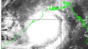
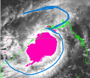
Take a latest look of a bilobular shape Cyclone Dana. The coloured areas shows heavy rain bearing clouds. A look shows the system face is towards Odisha shore. Heavy to very heavy rain likely from Puri to Balasore from tonight to tommorrow evening. The latest satellite image zooms on a outer ring shaped like '3' of Cyclone Dana has developed today, and the same traverses from Andhra Pradesh to West Bengal. Little rainbearing clouds seen over West Bengal (24 South Parganas).
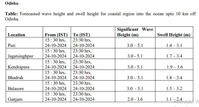
As per the release by ESSO-INCOIS, high waves in the range of 2.0 - 5.2 meters are forecasted during 3:30 pm to 11:30pm on Oct 24 along the coast off Odisha from Gopalpur to Chandipur. Similarly, high waves in the range of 3.0 - 5.1 meters are forecasted during 3: 30 hours to 11:30 hrs today along the coast of West Bengal between Digha and Bakkhali.
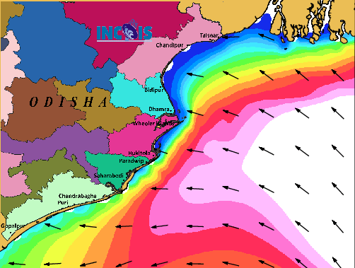 The image above shows high tides, sea swelling and direction of wind et al zeroing on Odisha coasts. The image clearly shows high tidal istorm impact on Kendrapada and Jagatsinghpur
The seas surface currents speed will also be higher at 1.8 -2.5 meter per second in Odisha as against 1-1.9m/sec in West Bengal
Here are the details in table for Odisha.
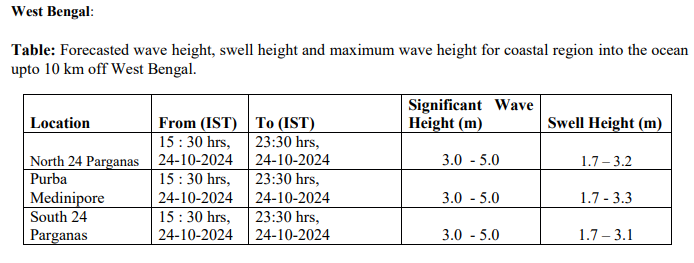
 Here are the details i ntable for West Bengal.