


By Sanjeev Kumar Patro
Bhubaneswar: The severe cyclone Dana is now past its prime ferocity. Weakening of the system has set in. The severe cyclone Dana has lost its youth phase, now gradually entering to its twilight days. It will become deep depression by noon and a depression by evening.
Stay tuned for more Cyclone Dana Live Updates!
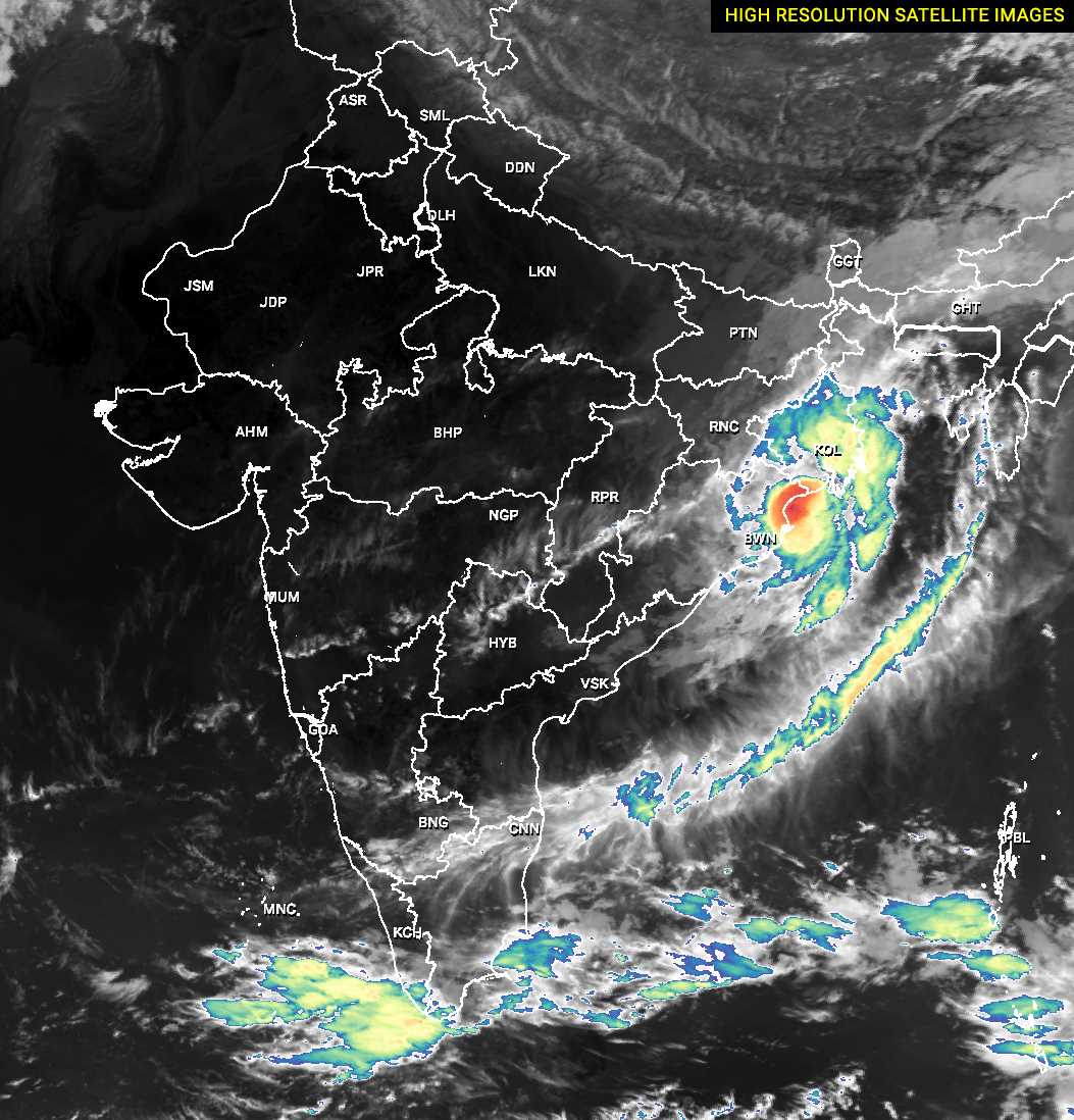
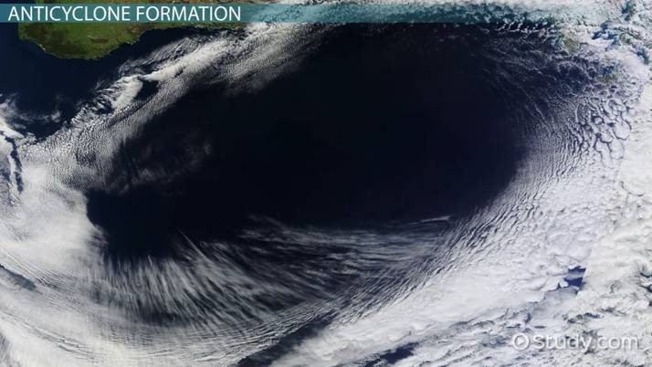
The depression form of Cyclone Dana will take west turn, will dissipate as a low pressure and take west-south turn tonight to travel towards Malkangiri in next 48 hours. See the main image where the Sun light is seen reflected by the cool cloud tops of Cyclone Dana
The cyclone Dana made landfall at Habalikhati nature camp, just 16km to the north of country’s famous coastal nursery – Bhitarkanika National Park – at around 2 am on October 25 or say past midnight at night hours of 2 on October 24.
At 10 am on October 25, the cyclone Dana is over Balasore and raining heavy there. Here are the following places in Odisha that have received heavy rainfall at 9am. Details given below.
- Highest Rainfall at 9am morning: Paradip – 62.9mm
- Next place that received maximum rain: Chandbali – 46.2mm
- Chandanpur (Mayurbhanj) – 29.2mm
- Nawana (Mayurbanj) – 27.4mm
- Rajkanika (Kendrapada) : 27mm
- Kujanga Jagatsinghpur – 27mm
- Nilagiri (Balasore) – 23mm
- Betanati (Balasoore) – 19mm
- Soro (Balasore ) – 19mm
- Dhamnagar (Bhadrak) – 16mm.
Meanwhile, the State Capital has recorded only 2.2mm rainfall (measured in the airport area), and Cuttack had recorded only 1.4mm rainfall. The impact of severe Cyclone Dana has been minimal over the twin cities of Bhubaneswar and Cuttack, despite IMD’s heavy rain and high wind warning.
WHY CYLONE DANA IMPACT MINIMAL OVER BHUANESWAR, CUTTACK?
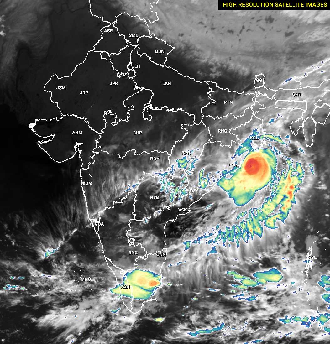
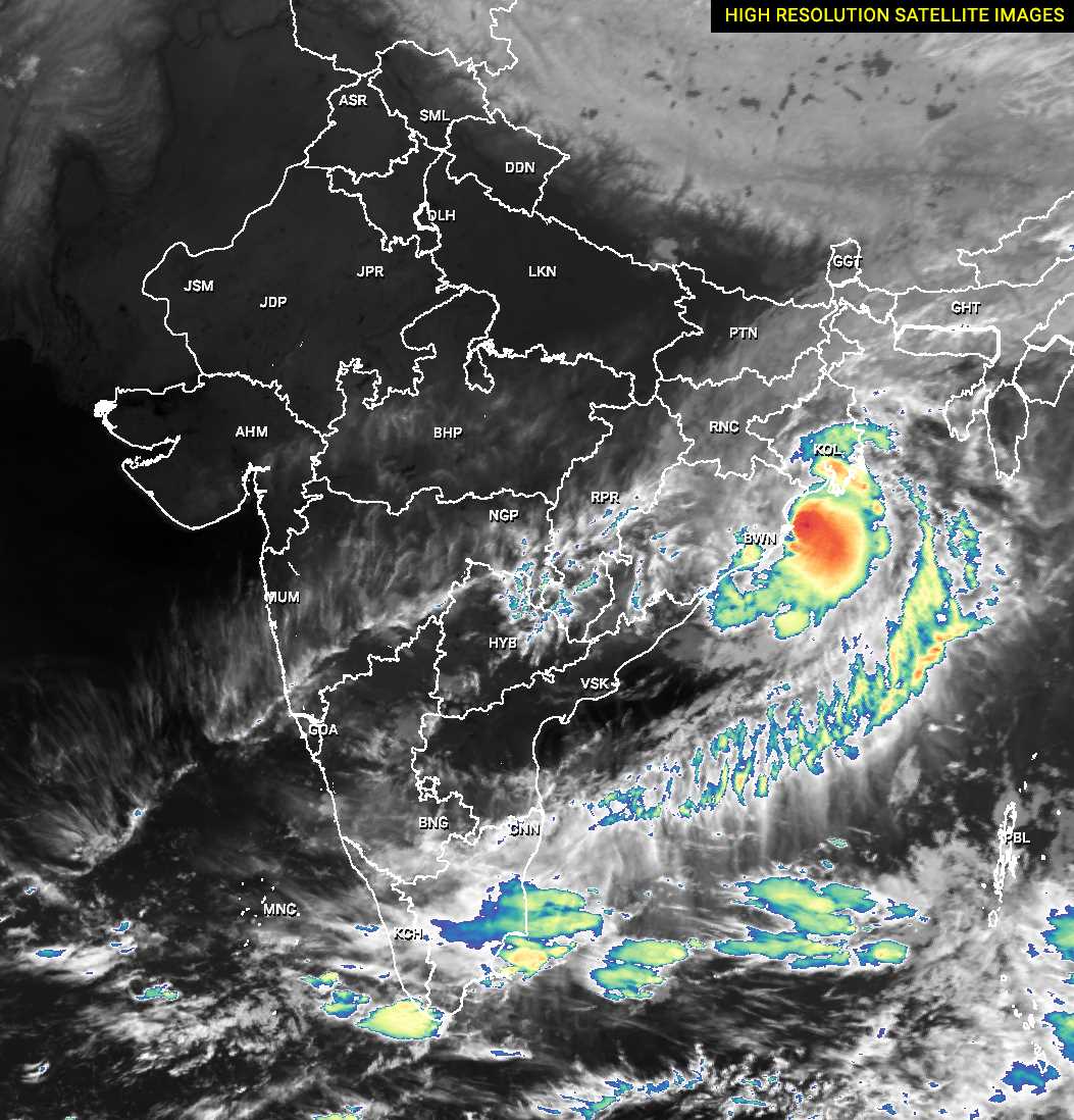
A glance at the cloud structure of severe Cyclone Dana when it was making landfall over Odisha’s Bhitarkanika reveals following big clues that explains why the impact was minimal over Bhubaneswar and Cuttack.
- Cyclone Dana’s strongest rainbearing cloud area size was not big enough to encompass 176km area.
- The heavy rainbearing cloud band extended upto Jagatsinghpur.
- The core central area of Cyclone Dana had the heavy rain cloud bands that could encompass the area from Paradip to Bhitarkanika to Chandbali, Dhamnagar et al.
- While making landfall, Cyclone Dana was not a bilobular structure. Rather satellite images show a structure with two weak small arms to north and south of the centre. The south arm is seen extending up to north Andhra coasts.
- In other cyclones like Cyclone Yaas, Cyclone Titli et al, the heavy rain clouds were packed to the periphery from the centre.
- Therefore, even as Cyclone Yaas crossed Balasore coasts, rain pounded Bhuaneswar, Cuttack. Also, despite Titli crossing the Palasa coasts, Bhubaneswar recorded a rainfall akin to Cyclone Dana.
WATCH THE LIVE IMAGES OF CYCLONE DANA LANDFALL
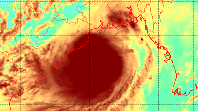
TIME 1:30: The heat engine cloud of Cyclone Dana piloting towards the Kendrapada coasts.
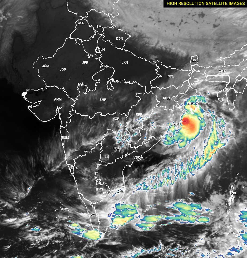
TIME 2:00 AM: The clear tilt of the coiled structure of severe cyclone Dana towards Bhitarkanika could well be seen with its two weak smaller arms and a big tail extending upto Tamil Nadu coasts.
TIME 2:30 AM: The high resolution SkySat images framed how Cyclone Dana is making its entry into Habilkathi Nature Camp , 16km from Bhitarkanika Nature Camp.

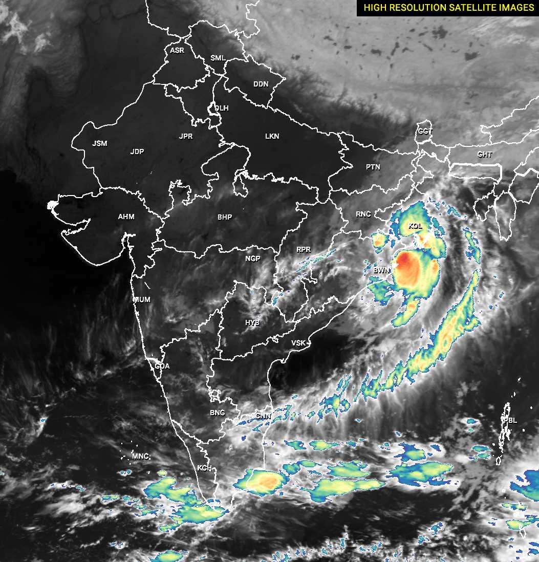
TIME 4:00 AM: The high resolution SKYSAT from high up in sky framed Cyclone Dana moving northwest passing over Dhamra, close to Chandbali towards Balasore and Mayubhanj .
TIME 6:30 AM: Severe Cyclone Dana entering Balasore coasts.
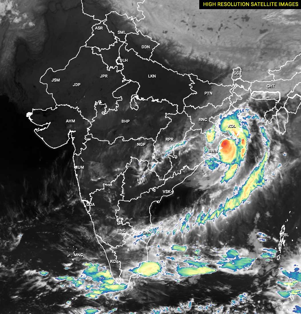
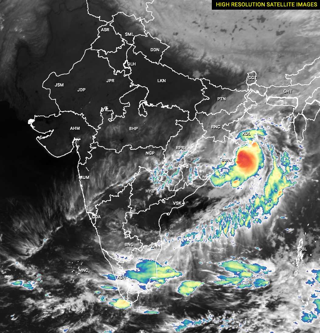
Time 10:00 AM: Sever Cyclone Dana engine stationed over Balasore and Mayurbhanj, with parts of its real bogeys still over Bay of Bengal. The coiled tail is withdrawn and lying over northwest Bay of Bengal. The cloud structure shows its weakened status. The size of heavy rain bearing raincloud bands have shrunk. Again bilobular structure formed, with the weaker lobe over West Bengal encompassing even Kolkata.