


Bhubaneswar, Feb 05: A catastrophic Glacial Lake Outburst Flood (GLOF) struck Sikkim’s Upper Teesta Basin on October 3, 2023, originating from South Lhonak Lake (5,200 m). The flood traveled ~385 km downstream, causing 55 deaths, 70 missing persons, and extensive damage to infrastructure.
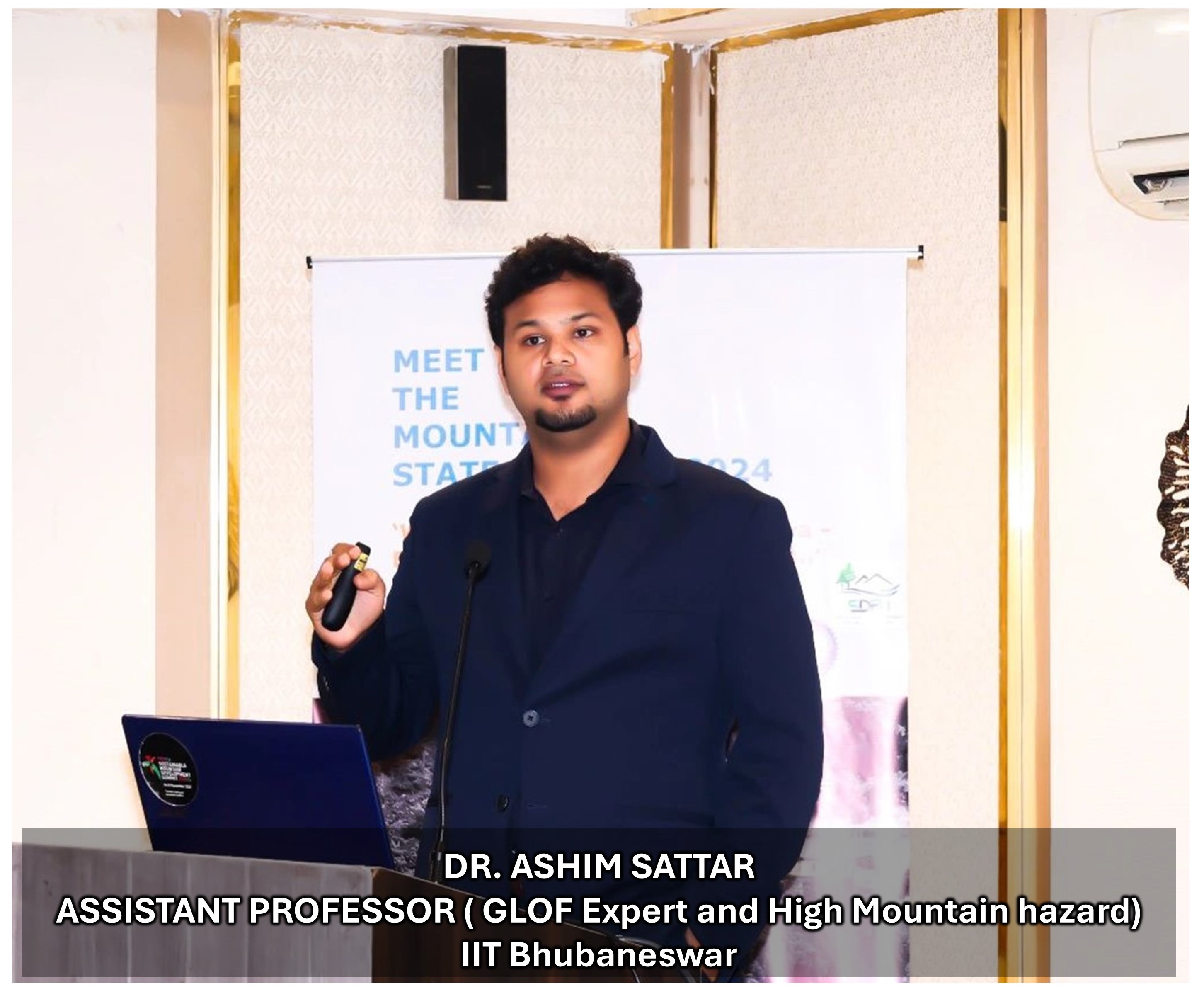
A study published in ‘Science’, led by Dr. Ashim Sattar from IIT Bhubaneswar, brought together 34 experts from nine countries to analyse the disaster. Using seismic data, satellite imagery, and modelling, they identified the trigger—a landslide of frozen ground at ~22:12:20 IST—releasing water equivalent to 20,000 Olympic-sized pools and causing a ~28 m lake level drop.
The study revealed that the part of the land that collapsed had been unstable for years, showing movement with a maximum velocity of 15 m annually from 2016 to 2023. GLOF modelling showed the flood reached Chungthang by 12:30 AM IST on October 4, destroying the 1200 MW Teesta III hydropower project and impacting Teesta V, Teesta VI, and Teesta Low Dams III and IV. "Teesta V and VI remain non-functional," noted co-author Rajeev Rajak. Co-author Wolfgang Schwanghart says, “Himalayan hydropower remains vulnerable to such extreme events, emphasizing the need for climate-adaptive risk mitigation.”
The flood eroded enormous volume of sediment—enough to fill 108,000 Olympic-sized pools—which was deposited downstream, devastating areas including Chungthang, Dzongu, Dikchu, Singtam, Bardang, Rangpo, Melli, Teesta Bazaar, and Geli Khola. High-resolution satellite imagery identified 45 landslides along the valley, damaging ~200 buildings and ~6.4 km of NH-10, isolating communities at places after the event. Road slumping persisted for months, notably at the Naga landslide. "Anticipating future GLOFs requires understanding cascading hazards like landslides and sediment mobilization," said co-author Kristen Cook.
The study also examined the role of a low-pressure system (LPS) from the Bay of Bengal that intensified rainfall, worsening flood impacts, particularly in West Bengal and Bangladesh. Findings highlight the need to monitor LPS activity for flood prediction in the Himalaya.
"The October 3-4 disaster highlights the urgency towards development of early warning systems in the valleys exposed to glacier hazards" stated Dr. Sattar. The event underscores the need for interdisciplinary hazard assessments, and stronger community preparedness to mitigate multi-hazard disasters.
Lead author Dr. Ashim Sattar called for a comprehensive strategy to mitigate GLOF risks, including robust downstream hazard mapping, stronger regulatory frameworks, improved GLOF modelling, and enhanced community education to protect Himalayan communities and infrastructure.
This study published in ‘Science’ highlights the effectiveness of remote sensing technology and modelling to evaluate natural hazards/disasters and their impacts. Odisha is also exposed to several natural hazards including cyclones and heatwaves. The state having a coastline of ~480 km, is exposed to coastal erosion and degradation.
The School of Earth Ocean and Climate Sciences (SEOCS), IIT Bhubaneswar has the necessary scientific expertise to critically assess these hazards and their impacts. “We have the expertise to monitor coastlines using remote sensing technologies, evaluate urban heat and heat stress, and apply remote sensing technology for urban planning. Also, Odisha is abundant in natural resources, and we possess the scientific expertise required to conduct detailed assessments of potential mineral zones for exploration and mine-site management using hyperspectral remote sensing and drone technology.