


Bhubaneswar's Future On the drawing Board
Bhubaneswar is a city on the move, growing rapidly and constantly changing. Like any thriving city, Bhubaneswar needs careful guidance to ensure it happens in a way that benefits everyone. It’s a roadmap for the future. Bhubaneswar Development Authority, or BDA, is the organisation responsible for creating and managing this roadmap. They're tasked with the important job for planning and how the city develops, balancing the need for homes, roads, and industries along with preserving green spaces and ensuring a good quality of life for residents. Recently, the BDA has been updating its plans, learning from the past, and looking ahead to shape the Bhubaneswar of tomorrow.
BDA's Role
Established in 1982 under the Odisha Development Authorities Act, the Bhubaneswar Development Authority (BDA) is the primary body guiding the city's physical growth according to plan. The BDA manages land, undertakes development projects, and creates official blueprints, ranging from city-wide Comprehensive Development Plans (CDP) to specific Local Area Plans (LAPs).
Looking Back: The 2010 Plan and Its Hurdles
The city's recent growth has largely been guided by a Comprehensive Development Plan (CDP) created in 2010, which looked ahead to the year 2030. Alongside this plan came "Vision 2030," a set of goals focused on major upgrades. This included building new major roads, improving parks, and significantly boosting housing – aiming for 400,000 new homes, especially for lower and middle-income families, often through partnerships between the government and private companies (Public-Private Partnerships or PPPs). The vision also promoted environmentally friendly industries like IT, planned new townships, and aimed for a cleaner city without slums. A key part of this 2010 plan was dividing the BDA area into 14 distinct zones for planning purposes.
However, putting this plan fully into action wasn't without its difficulties. A major challenge arose from unauthorised construction. Many people bought land and built homes in areas the plan had marked as restricted (like green zones or farmland) without getting the required approvals from the BDA. This created a tricky situation for both the residents and the planners, highlighting that the original plan needed some adjustments to match the reality on the ground.
Adapting to Reality:
Recognising these challenges and the city's changing needs, the BDA is now working to update the 2010 CDP. A big reason for this update is to find practical solutions for the unauthorised constructions that have already happened, aiming to protect the interests of people who built in areas that were previously off-limits. This involves carefully reviewing the zone classifications on the CDP map. It might mean changing some zone boundaries or the types of land use allowed to accommodate some of the existing buildings.
This flexible approach shows that rigid plans sometimes need to bend to the realities of a fast-growing city. It also seems the BDA is moving towards a more dynamic planning style, with reports suggesting a decision has been made to thoroughly review the CDP every five years. This allows for more regular updates and adjustments as the city evolves.
Planning for Tomorrow:
While adjusting the old plan for the existing city area, the BDA is also looking firmly towards the future and the city's expanding boundaries. They have prepared a brand-new Draft Comprehensive Development Plan (CDP) specifically for the areas around the current city limits, setting the planning horizon to the year 2040.
This new plan uses modern Geographic Information System (GIS) technology, essentially creating a detailed digital map for planning. It significantly increases the area under BDA's planning control, adding 364 nearby villages and expanding the total planning area to 705 square kilometers. The main goal of this CDP 2040 is to create a vibrant, sustainable, and livable environment for everyone through inclusive development, making the entire region well-connected and cohesive.
The Draft CDP 2040 is carefully structured, dividing the newly added area into 14 planning zones based on how they are expected to grow. It lays out proposed land uses (like areas for housing, industry, parks, etc.) and development stages. The plan considers everything from roads and transport to housing needs, essential services (water, power), financial planning, and how it will be managed. Importantly, it includes zoning rules that pay special attention to areas that might be vulnerable to natural hazards.
Creating this plan was a multi-step process, involving mapping the zones, studying current land use down to individual plots, deciding how land should be used in the future, planning infrastructure networks, and setting development rules. Crucially, this process included involving the public through discussions and hearings. The areas covered by this new plan already show a mix of housing and industry, especially along major highways, and have good potential for future growth thanks to available land and good transport links. This draft plan was officially announced around early March 2024.
This two-pronged approach – modifying the old plan while drafting a new one for expansion – shows BDA tackling both past issues and future opportunities simultaneously.
Building it Together: How Town Planning (TP) Schemes Work
A key tool the BDA is using to implement its plans, especially in the areas surrounding the city, is the Town Planning (TP) Scheme. It's a clever way to develop land collaboratively. Here’s how it generally works:
- Pooling Land: Landowners in a specific area agree to pool their individual plots together.
- Dedicating Land for Public Use: A portion of this pooled land (often around 40%) is set aside for public needs. This includes land for roads, parks, open spaces, community facilities like schools and health centers, and even affordable housing.
- Redistributing Developed Plots: The remaining land (around 60%) is then reorganized into properly shaped, planned plots with infrastructure access. These developed plots are given back to the original landowners.
This method has several benefits. It allows the BDA to provide essential infrastructure like roads and utilities without having to go through the often difficult and expensive process of buying large amounts of land outright. It gives planners better control over the layout and timing of development. Plus, TP schemes are designed to pay for themselves – the cost of developing the infrastructure is often covered by the increase in value of the developed plots the landowners receive back. It's seen as a fair approach that respects property rights while achieving community goals through partnership. Landowners benefit because the 60% of land they get back is usually much more valuable due to the planned development and new infrastructure (like proper roads, drainage, water supply, etc.).
TP Schemes and the Ring Road
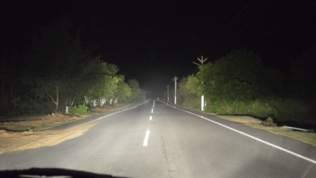
TP Schemes are playing a vital role in one of Bhubaneswar's major upcoming infrastructure projects: the proposed 64.9 km Ring Road, which was part of the original CDP 2010 vision. The BDA plans to use 45 separate TP schemes, covering 58 villages located along the path of this proposed road. The idea is to use the land pooling mechanism to gather the necessary land for the road and to encourage planned, sustainable development in these areas, minimizing the need for direct land acquisition by the government.
This heavy reliance on TP Schemes for such a large project shows a strategic shift. It uses private land contributions, motivated by the potential for increased land value after development, to build essential public infrastructure. This can reduce the financial strain on the government and potentially lead to fewer conflicts over land.
Work is already underway. As of late March 2025, significant progress was reported in the first four TP Schemes (covering nine villages). This included completing 60 km of road embankment (the raised foundation for a road) and nearly 65 km of drainage channels. Several culverts (small structures allowing water to flow under roads) were built, and 4 km of roads were surfaced with bitumen in certain areas. Public consultations for another scheme (TP Scheme VIII) were also in progress in early 2025. Looking ahead, the BDA is planning to launch 14 more TP schemes in one of the planning zones (Zone IV) to further drive planned development on the city's edges. BDA leadership is focused on speeding up the implementation of these schemes.
Going for a Balanced Future
Bhubaneswar's story is one of dynamic growth. The BDA's current efforts reflect a city working hard to manage this expansion thoughtfully. By both adjusting existing plans to deal with past realities and proactively charting a course for future growth in new areas using modern tools and collaborative methods like Town Planning Schemes, Bhubaneswar is striving to build a future that is not just bigger, but also more organised, sustainable, and livable for all its residents. It’s a continuous process of planning, adapting, and building – one step at a time.
Table: Comparison of Bhubaneswar Development Plans
Feature | CDP 2010 / Vision 2030 | Draft CDP 2040 (Extended Area) | Town Planning Schemes (General) |
Horizon Year | 2030 | 2040 | Scheme-specific, aligns with broader CDP goals |
Geographic Scope | BDA area as defined then (115 villages initially, expanded later) | 364 additional villages (Total 705 sq km planning area) | Specific designated areas, often peri-urban; 45 schemes planned along Ring Road covering 58 villages |
Key Objectives | Infrastructure, Housing (4 lakh units), Slum-free city, Green industry | Sustainable, inclusive, balanced growth; Cohesive & connected region; Improved quality of life | Provide serviced land prior to development; Orderly development; Infrastructure provision; Cost recovery; Public participation |
Zoning Approach | Division into 14 zones; Yellow, Red, Green, Blue zones | Division into 14 zones; Detailed land use allocation; Zoning regulations including hazard-prone areas | Land use defined within scheme; Reservation for roads, open space, social infra, EWS housing |
Infrastructure Focus | 6 Major roads, Parks renovation, Ring Road proposed (64.9 km) | Comprehensive infrastructure planning (transport, utilities); Connectivity focus | Road network (min. 9m width), drainage, water supply, sewerage, electricity within scheme boundaries; Facilitates larger infra like Ring Road |
Housing Focus | 4 lakh units planned (PPP); Focus on EWS/LIG/MIG | Integrated housing planning | Deduction for EWS housing within scheme |
Land Management Mechanism | Master Planning; Development Control Regulations | GIS-based Master Planning; Detailed zoning; Phased development | Land Pooling and Readjustment; Land deduction (e.g., 40%) for public purposes |
Noted Challenges/Revisions | Unauthorized construction in restricted zones; Under modification | Draft stage; Requires public consultation and government approval | Requires landowner cooperation; Implementation progress varies across schemes; Requires coordination for timely infra provision within redistributed plots |